The Chestertown Tea Party

Chestertown, Maryland sits along the Chester River on the northern part of the Eastern Shore of the Chesapeake Bay. I’d read about it but my travels always took me south on the Eastern Shore… to Easton, Cambridge, St. Michaels. During Covid I finally explored the colonial town, home to Washington College, chartered in 1782 and the first college founded after American independence. It’s a gem of preservation and small-town goodness.

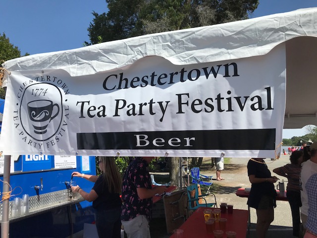
Last week a friend invited me to join her at the Chestertown Tea Party reenactment, an annual event on the town’s calendar. It commemorates the day in May, 1774, when Chestertown residents decided to copy Boston and have a tea party of their own to protest British excise duties. The tall ship Sultana docks most of the year in Chestertown and for the reenactment doubles as the British merchant ship Geddes, the ship that became the target for Chestertown’s ire.

I didn’t know what to expect, but as a good historian, did a little research prior to my trip. I’d heard about other tea parties in east coast towns (Annapolis, Yorktown, Wilmington, Charleston…) but I’d never heard about Chestertown’s protest. Then I noticed the word Legend, a word that intrigues every historian. Every historian wants to debunk myths and discover truth to legends. Many towns pride themselves on notable events from their past that lack evidence, but are a great story.

According to the Chestertown legend, the members of the local chapter of the Sons of Liberty were outraged by the taxes on tea and local leaders adopted the Chestertown Resolves, making it unlawful to buy, sell, or drink tea from England. When word came that a recently arrived ship held tea, a small group of men forcibly boarded the ship and threw the tea into the river. Unlike in Boston, this event supposedly occurred in daylight and the men wore no disguises. In 1968 the town staged its first tea party reenactment, and most every year since the nation’s bicentennial in 1976. This patriotic feel-good event brings the community together.

And yet… I’m thrilled when a town wants to celebrate its past in such a public way – with a parade, street fair, and a reenactment. But… the only problem is there is no contemporary documentation the event happened. The Resolves were printed in the Maryland Gazette, but no notice about the tea party exists in the Gazette or any other colonial paper. The first mention of it in the historical record is not until 1899 and that record does not cite a source. No other sources have been uncovered over the years. Researchers have been able to verify that the ship Geddes, built in Chestertown, was in the area during the right time. Whether or not she held tea has not been documented.

The day dawned sunny and perfect and my friends and I enjoyed the festival. Just before show time, we walked out to the dock to see the ship, but it was pulling away from dock to be in place for the show. So we stayed out on the dock, only sixty or so feet from the action. Surrounded by locals, I asked them about the reenactment and they fully acknowledged it’s based on legend. Unfortunately, while we avoided the crowds on shore, we missed the narrative explaining the events that led up to the point where “townsmen” jumped in a row boat and rowed out to the ship. The ship’s small cannons boomed in warning. Just then, to our disappointment, the wind shifted and the ship moved slightly to block our view of the action. The men climbed on board somehow and then the mock fighting began. We could see exaggerated fists pummeling the air — a contactless brawl. Then one by one the big boxes clearly marked TEA were hurled overboard to the cheers of the audience. The women near me said it used to be more fun when the colonists could throw the British soldiers into the river, too, but they said the Coast Guard no longer allows this. The watchful eye of a Coast Guard cruiser lurked nearby.

When the last box of tea had been chucked into the river, the large British Red Ensign flag waving in the wind at the stern was lowered, and replaced with a stars and stripes flag (which of course didn’t exist in 1774 because the United States did not exist then – but a small inaccuracy!) Patriotic Americans on shore cheered.

I had a fun time, steeping (couldn’t resist) in history that may or may not have taken place. I’m always happy when a town commemorates its past – as long as it acknowledges a legend. No doubt many of the people who came to the festival and ran in the races and marched in the parade think the event actually happened. But the spirit of historic protest and good fun seemed to bring a community together, so that’s a good thing. Right? It’s good anytime the public is encouraged to focus on history!

What do you think?

Related posts

A French frigate arrives

A historic inn on the Eastern Shore

Posted in 18th century, American Revolution, city/town | Tagged , , , | Leave a comment

A gem of preservation in a complex story

Natchez, Mississippi sits on a bluff overlooking the Mississippi River about 170 driving miles upriver from New Orleans. Its history runs deep, as tribal lands of the Natchez Indians to French settlement beginning in 1716. Today the town is perhaps best known nationally for it amazing collection of antebellum homes, many built in the years before the Civil War when cotton was king and men were becoming obscenely wealthy off the backs of enslaved labor. Known as the Natchez Nabobs, many of them moved to Natchez from other parts of the US or Europe and their combined wealth gave the county the distinction of wealthiest county in the United States. They left behind a city filled with grand homes that have survived war and economic depression. I’d long wanted to see the city and recently seized an opportunity when a friend relocated to the area.

My friend and I arrived in Natchez just after the “spring pilgrimage,” a period when select private homes are open to the public. We decided to visit Stanton Hall, open to the public year-round. Sometimes described as one of the most opulent antebellum mansions to survive in the southeastern United States, Stanton Hall, a columned palatial Greek Revival mansion, sits on an entire city block surrounded by a wrought iron fence. While I had never heard of the Stanton family who built it, the fact that the house had served as a setting for the 1980s miniseries North and South, (as the interior of the Main family home), was an added bonus. Construction on the house ended in 1857 and the owner, Frederick Stanton, a cotton broker from Ireland, moved in and sadly died of yellow fever only nine months later. In 1861 most of the town’s wealthy citizens opposed secession, but their sons ran off to join the Confederacy. Despite the town’s vote against secession, their state seceded. In 1862, Confederate forces surrendered the city to Union officials and thus avoided wartime destruction unlike neighboring Vicksburg upriver.

Stanton Hall is filled with opulence and beauty. I love historic house museums, especially those that feature distinct architectural designs. But I expect that a tour will offer insight on the people who built and lived there and what their daily life entailed. My interest in decorative arts – the furniture, painting, carpets and light fixtures – only goes so far. I need a human hook to hang the information on. I’ve noticed that at homes where the vast majority of visitors have never heard of the owners, (like the Stantons) the tour often focuses entirely on decorative arts and potentially loses the attention of much of the audience. Tell me why I should care about the Stantons and how their life contributed to the overall narrative of American history. I want context! The tour of Stanton Hall did keep my interest, despite an ongoing narrative about the light fixtures. Intriguing side stories about filming North and South and about General Douglas MacArthur and his family’s stay when the house was a bed and breakfast were interesting. But what was life like for the Stantons and the people who served them? Yes, of course the Stantons owned a number of enslaved people who essentially ran the household operations. Who were these people? Not a mention of them. At the end of the tour I felt as if a big part of the Stanton Hall story had been left out. Certainly the limited time of an hour tour requires hard decisions of what stories to include. Every house museum faces this challenge. But historic house museums, wherever they are, have a responsibility to offer a more holistic interpretation. If little documentation of the enslaved people from a specific site exists, then draw comparisons from a similar site.

Often I will read a book or two prior to visiting a new place. I stumbled upon The Deepest South of All: True Stories from Natchez, Mississippi by British journalist Richard Grant and loved it. Part Midnight in the Garden of Good and Evil and part Confederates in the Attic (by one of my favorite writers, the late Tony Horwitz), it offers a peek into the challenges of presenting the history of the town and of navigating centuries of racial animosity. I highly recommend the book.

An important site in town that Grant wrote about was the Forks of the Road, a small piece of land farther from the city center, surrounded by auto repair shops and busy roads. Here the second largest slave market in the US at one point in history served as a crossroads for the domestic slave trade and thousands of enslaved souls were allowed to rest before being sold. Thankfully large panels interpret the history and a sculpture depicting slave manacles in concrete conveys the power of this place, despite the incongruous setting. Recently the site was transferred to National Park Service ownership.

We ate lunch looking out on the Mississippi River in the lower part of town, Natchez-Under-the Hill, where the rowdies from the riverboat culture enjoyed brothels and gambling halls and taverns and other such dens of iniquity. Then we walked the streets of Natchez, gawking at the beautiful old homes, such as Choctaw Hall (below). I did not get to spend enough time in this fascinating city and concluded that its layers of history deserve much closer examination and reflection. For Natchez is a city of extreme contrasts: its architectural beauty built by enslaved people. Hopefully some day I will return.

Related post: Houmas House, a Louisiana plantation

Posted in 19th century, city/town, house | Tagged , , , | Leave a comment

Vicksburg, at last

I grew up in Pennsylvania, a little over an hour from Gettysburg, and have made numerous trips to one of America’s most iconic battlefields. I learned the movement of armies over three days of the battle and stood transfixed by the photos of sharpshooters at Devil’s Den. Another iconic name came to be associated in my mind with Gettysburg: Vicksburg. A world away in Mississippi, the southern city fell to the Union army the day after the Confederate loss at Gettysburg — July 4, 1863. The one-two punch is often considered by historians as the turning point of the Civil War. While over time I visited various other eastern Civil War battlefields, Vicksburg remained at the top of my to-see list.

Vicksburg battlefield

Recently, I checked Vicksburg off my list. Anyone who has read my writing knows I’m all about the power of place to fuel the imagination. Vicksburg did not disappoint. Driving eastward from Louisiana, as I did, a traveler traverses flat fields. Once across the Mississippi River, the bluffs rise immediately on the river’s eastern shore and there sits Vicksburg – high on these bluffs. One can immediately see why it was a natural defense and why the town was the last point on the Mississippi left for the Union to conquer. The fall of Vicksburg after a six-week siege brought the Union full control of the Mississippi River and cut the Confederacy in two.

During the siege the city and its 27,000 soldiers and 3,000 non-combatants were cut off from the world, surrounded by gunboats, soldiers and batteries, the civilians forced to take cover in crudely dug caves. Mark Twain described their existence in his book Life on the Mississippi: “all in a moment come ground-shaking thunder-crashes of artillery, the sky is cobwebbed with the crisscrossing red lines streaming from soaring bombshells, and a rain of iron fragments descends upon the city, descends upon the empty streets — streets which are not empty a moment later, but mottled with dim figures of women and children scurrying from home and bed toward the cave dungeons– encouraged by the humorous grim soldiery, who shout ‘Rats, to your holes!’ and laugh.” Surrounded by a 12-mile ring of Union troops, the inhabitants of Vicksburg struggled to survive for 46 days.

Sixteen miles of National Park Service roads traverse the preserved battlefield in Vicksburg National Military Park and tell the story. As my friends and I drove the park road, we were immediately struck by the hilly, ravine-filled landscape. Deep chasms cut steeply down a mere ten feet from the road. As with other Civil War battlefields, large elaborate state memorials dot the grounds, citing the bravery of those who gave their lives. While Union general Ulysses S. Grant is by far the most well-known of the many characters in the story of Vicksburg, the existing journals of ordinary citizens detail the harrowing existence for civilians trapped in the town.

My favorite section of the park was the high bluff north of the city, which provides a stunning view of how the river has changed course over time. Today the Mississippi River takes a sharp turn west just below this spot, whereas during the battle it flowed at the base of the bluff. The present-day Yazoo River diversion, an illusory Mississippi River of sorts, helps a visitor imagine the reality in 1863. At the bottom of the bluff, the national cemetery sprawls over rolling ground, the final resting place for nearly 17,000 federal soldiers (about 13,000 of which are unknown).

Nearby sits the U.S.S. Cairo Museum, a fascinating feature of the park. The ironclad gunboat Cairo was one of six built to ply the Mississippi River. When an explosion tore through it on December 12, 1862, it sank in minutes, the first vessel sunk by an electrically detonated torpedo (mine). All 175 crew on board survived. Buried in feet of Mississippi mud, its resting place remained hidden until discovered in 1956. Carefully raised to the surface, its remains are now meticulously preserved under a large canopy, and a small museum tells its story. It is one of only four surviving Civil War ironclads in existence.

Vicksburg is unique among America’s Civil War battlefields, certainly for its story, but also for its landscape. Whereas the town of Gettysburg became an accidental battlefield forever etched in the history of the nation, Vicksburg was an inevitable moment, a fortress that had to be conquered to bring northern victory and bring the nation together again.

Related Posts:

One of the Most Powerful Views

The Power of Appomattox

Posted in 19th century, cemetery/grave, Civil War, military, national park | Tagged , , , | 3 Comments

A few of my favorites at Christmas

Everything has a history, even the celebration of holidays. Some people who visit eighteenth century historic sites at Christmas ask where the Christmas trees are. Trees are a nineteenth century thing. George Washington never put up a Christmas tree at Mount Vernon. (But he did bring in a camel to amuse his holiday guests!) Even Santa changes his look from time to time. I am fortunate to live in the Washington, D.C. area, abundant with history places of all shapes and sizes. Below are three of my favorite posts from Christmases past. From a tour of Mount Vernon’s basement and a surprise camel appearance, to Santa at a Civil War fort, and the spectacular beauty of the U.S. Botanic Garden, enjoy these musings on historic sites at the holidays.

And if you’re looking for a gift for history lovers in your life, my latest book, The World Turned Upside Down: The Yorktown Victory That Won America’s Independence, is available at booksellers everywhere. It’s a tale of both military strategy and spies and secrets, including the little known story of James, an enslaved man who served as a spy for General Lafayette at great risk, hoping to secure his freedom. Check out my other books here.

Merry Christmas and Happy New Year to all! I hope you’ve started dreaming about which history sites you could visit in 2023. I already have… I haven’t been to Charleston in a long time, a friend moved to a new town in Louisiana closer to two places I’ve always wanted to visit, Vicksburg and Natchez, my list is beginning.

Posted in Uncategorized | Leave a comment

One of America’s most remote national parks

By guest blogger Jay Blossom

Hurricane Ian cut a catastrophic path across Florida on September 28, 2022, causing at least 109 deaths and resulting in perhaps $47 billion in damage. But before its landfall near Fort Myers, the storm had also landed on Cuba, and it had already hit one of America’s most remote and pristine national parks.

Fort Jefferson was constructed between 1846 and 1874 and is today the centerpiece of Dry Tortugas National Park. Photo by Jay Blossom, November 5, 2020.

Just one day before, on September 27, 2022, Ian passed directly over Dry Tortugas National Park, a cluster of seven islands located 68 miles west of Key West, Florida. The combined area of all seven islands is between 100 and 150 acres, but 99 percent of the park’s area is the protected ocean surrounding these islands, with extensive coral reefs that support seabirds and undersea wildlife.

President Franklin Roosevelt declared Fort Jefferson to be a National Monument in 1935; in 1992 it became Dry Tortugas National Park. Photo by Jay Blossom, November 5, 2020.

In the midst of this tropical wonderland rises Fort Jefferson, surely one of the most remarkable structures within the National Park System. Constructed entirely of brick brought in by ship from Pensacola, the fort was begun in 1846, with construction continuing for 31 years before the Army abandoned the effort, still unfinished, in 1874. With 16 million bricks, and covering 16 acres, Fort Jefferson is the largest brick structure in the New World.

Fort Jefferson was constructed with more than 16 million bricks provided by a Pensacola firm. Photo by Jay Blossom, November 5, 2020.

I had the pleasure of visiting the fort on November 5, 2020, during a visit to the Florida Keys. The Yankee Freedom, an authorized concessioner of the National Park Service, offers a daily catamaran trip from Key West to Fort Jefferson. As the fort came into view, visitors like me had to wonder why the Army built a vast fort on a remote island at such great expense. What were they trying to protect? Whom were they trying to intimidate? Was it worth the cost?

The answer, in part, is pirates.

An interpretive panel at Fort Jefferson explains its significance to 19th-century shipping. The fort’s massive guns protected the deep-water harbor just to the north. “Enemy ships could easily bypass the guns, but they could not avoid the warships that used the anchorage.”

After Spain sold Florida to the United States in 1820, coastal trade rapidly increased between the Atlantic Seaboard of the United States and New Orleans, the port near the mouth of Mississippi. And ships traveling that route were prevented from hugging the south coast of Florida by the Keys, a coral archipelago that extends 180 miles in a gentle arc into the Gulf of Mexico. En route from the U.S. East Coast to New Orleans, sailors stopped at the Dry Tortugas, the last of these Florida Keys. Spanish map-makers had even given these islets a name that indicated that food could be found there — tortugas means “turtles,” and green and loggerhead turtles still use the islands as a nesting place. (Unfortunately, there is no fresh water to be found, which is why later British cartographers added the adjective “dry” to Spanish maps.)

Challenges for 19th-century sailors along this route included tropical storms, invisible coral reefs, a lack of fresh water, and piracy.

In 1825 and 1826 a lighthouse was constructed on one of the Tortugas to aid in navigation. A few years later, in 1829, the survey ship Florida stopped in the islands and later reported that they offered a protected harbor that, if occupied by a hostile foreign power, would put U.S. shipping in deadly peril. On the other hand, if the U.S. military preemptively fortified the islands, U.S. commercial vessels would be protected, both from piracy and from even bigger potential problems like the Spanish navy.

In 1845, the Tortugas finally became a national military reservation, and construction of the fort, which would occupy almost the entirety of one of the seven islands, began the following year. Plans for the fort included a 13-acre parade ground surrounded by a hexagonal curtain wall with corner bastions.

Perhaps the most interesting part of my tour of Fort Jefferson was hearing about the great privations that both the construction crews and the soldiers endured during the 30 years that the fort was being built by both enslaved and free laborers. Water was always in short supply — even with innovative steam-powered condensers that provided up to 7,000 gallons of desalinated water per day. Disease was rampant, death was common.

During the Civil War, the United States occupied Fort Jefferson to prevent it from falling to the Confederacy, and the fort became a prisoner of war camp. By late 1864, 583 soldiers and 882 prisoners lived there. But the following year, Fort Jefferson’s most infamous convicts arrived: Samuel Mudd, Edman Spangler, Samuel Arnold and Michael O’Laughlen, convicted co-conspirators in the assassination of Abraham Lincoln. Mudd, the doctor who treated John Wilkes Booth’s broken leg, attempted and failed to escape on a departing ship in September 1865. Two years later, after the prison’s regular doctor died during a yellow fever outbreak, Mudd took over the medical care at the fort. As a reward for his service during the crisis, he was assigned to a desk job at the fort until he was pardoned by President Andrew Johnson in March 1869.

Twenty years later, the Army abandoned the fort altogether, and it became a quarantine station and then a coaling station before being reactivated during the Spanish-American War. After 1906, the fort was once again abandoned until President Franklin Roosevelt declared it a national monument in 1935. In 1992, Dry Tortugas National Park was established.

Today the fort is inhabited by a few employees of the park service. One woman staffed the gift shop on the day I visited; she said that because of recent bad weather, she hadn’t any internet or cellular service for days and didn’t even know that our boat was going to be arriving that morning. Our ship provided a guide for the history of the fort, as well as snorkeling equipment for those who wanted to explore the reefs surrounding the island. We used the toilets on the ship and also ate lunch on board, or we took sack lunches out to one of the picnic tables near the fort’s entrance. There are no services provided at the fort itself.

On the way back to Key West, my fellow passengers and I discussed whether we could actually see ourselves living in this remote paradise, 70 miles by water from the nearest car, house, or store. Most said no.

Hurricane Ian, which made landfall on September 27, 2022, apparently caused significant damage to the fort’s piers, pictured here on November 5, 2020. Photo by Jay Blossom.

Aerial photographs taken in the days after Hurricane Ian’s landfall indicate damage to Fort Jefferson’s piers and damage to vegetation within the parade ground, with extensive flooding. Predictably, the storm also altered the sandbars that surround the islands and uprooted trees everywhere. Seaplane charters from Key West are once again being allowed to land, but as of October 6, 2022, the Yankee Freedom had not yet resumed its trips.

Related blog post: Tracking a Killer

Posted in 19th century, Civil War, fort, International, national park | Tagged , , | 1 Comment

Meet James, the enslaved man who spied for Lafayette

Interstate 64 connects the present capital of Virginia, Richmond, and the former capital, Williamsburg. About midway between sits New Kent County. Tourists drive through it on their way to history sites and amusements in Williamsburg, or to the beach, but most don’t pay it any attention. George Washington enthusiasts know it as the county where Martha Washington lived with her first husband and the site of George and Martha’s wedding.

I wish more people knew about a fascinating person from New Kent who played an important role leading up to the siege of Yorktown and the Allied victory which brought the end of the American Revolution. James Lafayette’s story is both intriguing and unique – because he was an enslaved Virginian who served as a spy for General Lafayette.

James was born enslaved in the county, most likely in 1748, and served the Armistead family. He grew up in an enslaved community that surely dreamed about what life would be like as free people. He had no control over his daily life or his future. But sometime in 1781 he decided to seize an opportunity that would ultimately set his course toward freedom. He could have chosen to run to the British — they invaded Virginia in 1781 and many enslaved people decided to seek freedom with the British, a risky venture with no guarantee in the end. But he didn’t.

General Lafayette

In early 1781 General George Washington sent Major General Lafayette to Virginia to capture the traitor Benedict Arnold who was then working for the British. Lafayette, was the young man who, at age nineteen, had come from France to help the American cause. But soon General Charles Cornwallis moved his troops into Virginia from the south and Lafayette had more to worry about. The British cavalry roamed the land, leaving a wake of destruction in their path and terrorizing the citizens of the state. Outnumbered, Lafayette could only monitor British activity and engage in small skirmishes. Lafayette needed to find a way to learn the British military’s next move. He needed eyes and ears in the British camp. No doubt General Washington, a person who recognized the value of strong intelligence, encouraged him to develop a spy network.

While history sources don’t reveal the exact moment, at some point in either spring or early summer 1781 Lafayette and James met, and Lafayette realized that using an enslaved man as a spy would provide him with vital information. And so began an interesting relationship of two people who were unlike each other. Lafayette was from a French noble family. He had inherited his title Marquis from his father who had died in battle against the British. Lafayette, one of the wealthiest men in France, was friends with the King and Queen of France.

My new book, The World Turned Upside Down: The Yorktown Victory That Won America’s Independence tells the story of the pivotal last conflict in the American Revolution and one of its main characters is James. Since the book is nonfiction, it took me a while to decide whether enough historical source material existed to include James’ story. Enslaved people and spies did not leave much evidence behind. James remains a mysterious person today, but several key documents tell us about him.

Lafayette mentioned him in correspondence to Washington, but not by name. Letters often got intercepted by the enemy. He refers to him as “a correspondent of mine,” and “this servant I have once mentioned.”

Despite holes in James’ story, we know he risked his life to serve as a spy and ended up working in the British camp. Upon war’s end, he was not granted his freedom, and ended up petitioning the Virginia legislature for freedom. Lafayette wrote a letter endorsing his manumission, stating James had served as his spy. He wrote: “This is to certify that the bearer by the name of James has done essential services to me while I had the honor to command in this state. His intelligences from the enemy’s camp were industriously collected and faithfully delivered.”

Three main questions loom large in James’ story: When did he start spying for Lafayette and who initiated it? Where was he during the siege of Yorktown and the surrender? What exactly was his role with General Cornwallis? Was he a double agent?

James did eventually gain his freedom from the state of Virginia. On January 9, 1787, the Speaker of the House signed a bill that stated: “Be it there enacted, that the said James, from and after passing of this act, enjoy as full freedom as if he had been born free.” When asked to select a surname, he chose Lafayette and would be known for the rest of his life as James Lafayette.

It is impossible with present evidence to determine the exact relationship between the two men. Clearly Lafayette felt strongly about James securing freedom and spoke out against the practice of slavery on numerous occasions. The General and James were destined to meet one more time. In 1824 Lafayette, then 67 years old, the last living French general of the American Revolution, embarked on a tour of the United States. During his visit to the Yorktown battlefield, the Richmond Enquirer reported that “a black man… who had rendered him service by way of information as a spy, for which he was liberated by the state, was recognized by Lafayette in the crowd, called to him by name and taken into his embrace.”

James Lafayette, collection of the Valentine Museum, Richmond, Virginia

At some point in later life, James took a job at a grist mill and purchased 40 acres of land in New Kent County. He encountered an artist, John Blennerhasset Martin, in Richmond, who became fascinated with his story and painted the only known portrait of James. At that point he was about seventy-six years old and living a quiet life in New Kent County. Today the portrait is on display at the Valentine Museum in Richmond.

A staff member at the New Kent County Historical Society shows off a new reproduction of James’s portrait.
Posted in 18th century, military, national park | Tagged , | 1 Comment

Not just a field

“It’s just a field, dad,” many a bored teenager has whined on a family trip to a battlefield. Battlefields require imagination to understand their significance and over the years, I know many National Park Service staff have struggled with how best to interpret a grassy landscape.

One field in Yorktown, Virginia, holds a special place in American history as a field not only of battle, but also of surrender. The siege of Yorktown in 1781 essentially ended the American Revolution and signified the birth of a new nation “conceived in liberty” as a future president would say while standing on a different battlefield (Gettysburg).

Today “surrender field” looks like an ordinary field of grass. On a beautiful day it is bucolic, lacking only a herd of peacefully grazing sheep. If we had the power to travel back in time to October 1781, the view would radically change. The air would be filled with cannon balls from approximately 73 cannons, including a nighttime display of red hot cannon balls flying through the air. It was anything but peaceful. The ferocity of the guns created an earsplitting pounding that could be heard many miles away. Around nineteen thousand people, more people than most cities in the thirteen colonies, had gathered to launch a siege on the British army in the small village of Yorktown. General George Washington, commander of the Continental army, and his ally, the French general Rochambeau, along with the French Admiral de Grasse, worked together to entrap British general Lord Charles Cornwallis and his troops. The French and American armies had marched five hundred miles from New York. With help from the French navy recently arrived to block the entrance to the Chesapeake Bay, they surprised the British and Germans and surrounded them.

Finally, at 10:00 a.m. on October 17, a lone British drummer boy appeared on the parapet and began beating a signal. Beside him stood a soldier waving a white handkerchief. No one could hear the drummer due to the pounding of the guns, but the handkerchief spoke volumes and one by one the cannons ceased firing. Cornwallis was surrendering at last.

John Trumbull’s Surrender of Lord Cornwallis (though Cornwallis is not in the image)

Two days later a long column of British soldiers marched out from Yorktown, between two lines, one American, one French, and lay down their arms. Surrender field today is a grassy field preserved for future generations. On October 19, 1781, thousands of civilians came to witness the surrender. The event has been depicted by numerous artists, including John Trumbull’s famous painting located high up in the Capitol rotunda, and a less well-known painting by a French artist, Louis Van Blarenberghe, completed for King Louis XVI. Both portray the moment of great elation for the Americans and French and the great humiliation for the British and their hired Hessians. All of the big names were there… Washington, Lafayette, Hamilton, except the vanquished Cornwallis who feigned illness.

Louis Nicolas Van Blarenberghe painting of the Yorktown surrender, 1786

While the British still maintained troops in three other areas of the American states (New York City, Charleston, and Savannah), the will for war was rapidly waning across the ocean and the winds of public opinion began to shift. Yorktown would be the last major conflict of the American Revolution, and while a big victory at the time, no one knew it would be a harbinger of a new world order — in time.

My new book for ages 10-14, The World Turned Upside Down, tells the story of the siege of Yorktown. As part of the story’s broader context, it includes the fascinating relationship between the Americans and the French and the story of the secret march to Yorktown. The incredible story ends at Yorktown, but has many beginnings and colorful characters. The young 19 year-old French nobleman Lafayette, so caught up in the passion for the American cause of freedom that he defied the orders of his king and fled France. The enslaved man, James, who ended up serving as a spy in the British camp for Lafayette. And even the French general Rochambeau who was planning his retirement when he was suddenly sent to America. And George Washington, in some ways the most unlikely commander in chief who had never led an army into battle.

My hope is that the book will inspire many family trips to Yorktown and its readers will not complain that “it’s just a field.”

Surrender Field, Yorktown

Posted in Uncategorized | Leave a comment

Talking with a teacher about history

It’s coming soon! My next book, The World Turned Upside Down: The Yorktown Victory That Won America’s Independence, will be published on April 12 and I’m planning several upcoming posts to focus on the Yorktown story. If you’ve never visited Yorktown, Virginia, put it on your list of great American historic sites. The Siege of Yorktown was undoubtedly a pivotal moment in American history.

Yesterday I filmed a video about the book with my friend, Kelli. She teaches 7th grade English at a local public school in Virginia. She’s also a fellow writer, we met in a local writers group. Kelli asked me a lot of great questions and I can’t wait to share the final video. Here are a few of the highlights.

James Lafayette, collection of the Valentine Museum, Richmond, Virginia

Where did the idea come from? Readers always want to know where book ideas originate. In this case, I saw a cover story about James Lafayette in a history magazine. I was curious about this person from the past who I’d never heard of… an enslaved who served as a spy? What a fascinating combination. James became a spy for General Lafayette during the summer leading up to Yorktown in 1781. His life is mysterious, but his story is documented in several state records and his portrait, painted from life, is on display at the Valentine Museum in Richmond.

Kelli asked me what the book is about. The theme is freedom, but the various characters define freedom in different ways. For James, it means personal freedom. For General George Washington and other patriot leaders it means freedom for a people to govern themselves. One of the book’s storylines describes the challenges that enslaved people faced in seeking freedom. The British offered freedom and many enslaved people equated the red coat and the Union Jack flag with freedom, but in reality formerly enslaved people faced great uncertainty if they ran to the British. There was no guarantee of freedom.

Kelli pointed to a passage from the book and asked how I can write so vividly about an event, in this case Jack Jouett riding up the steep hillside at Monticello to warn Thomas Jefferson that the British were on their way to capture him. I said because I’ve visited Monticello, Thomas Jefferson’s preserved house, many times and when I’m writing, I can picture it. Readers of this blog know how much value I place on seeing the sites where history happened.

Letter from George Washington to his dentist, May 29, 1781

Kelli also asked me why a middle school student would want to read the book. Valid question. My answer: Because it tells an important story in American history, but also because it contains great stories about spies, and who doesn’t like spies? My favorite primary source document in the book is a letter that General George Washington wrote to his dentist in Philadelphia requesting tools to care for his teeth. The letter was intercepted by the British. Since both sides were known to add fake dispatches in their mail to trick the enemy, the British had to first authenticate the letter. After they decided it was real correspondence, they analyzed it and decided it meant that Washington wasn’t planning to head south from New York anytime soon. He was staying north and would most likely attack New York City, occupied by the British.

The book is filled with over 60 images, mostly color, of fascinating primary sources like the dentist letter. They include French and British maps, portraits, and the famous John Trumbull image of the surrender at Yorktown located in the US Capitol rotunda, and a little known image of the surrender painted for the French court.

Thanks, Kelli, for talking with me. Look for the video soon on my website, timgrove.net.

For my latest author news, follow my author page on Facebook @timgroveauthor.

Posted in Uncategorized | Leave a comment

Announcing my next book…

Hi everyone. I’ve been writing fewer blog posts recently because I’ve been busy with several book projects. And, because I wasn’t visiting historic sites during Covid — since so many were closed. (Was just at Mount Vernon last week, but I’ve written many posts about MV. Do a search, you’ll see!)

Anyway, I’m excited to share that my next book, about a historic site, will be out April 12, 2022. Here’s the cover. If it looks like my current book, Star-Spangled, that’s because the design complements that book. Both are about pivotal points in American History.

Here’s a past post about Yorktown, but it appears I need to start writing a few more. Look for them leading up to publication in April.

Posted in Uncategorized | Leave a comment

The Colonial Marines and Tangier Island

IMG_0993

In celebration of African American history this month, I’m sharing the link to an article I wrote for the current issue of Chesapeake Bay magazine. It’s adapted from my book, Star-Spangled, and tells the fascinating story of the Colonial Marines, formerly enslaved men who fought for the British during the War of 1812. Their base was on Tangier Island. In case you missed my blog post in 2019 about my visit there, here it is again. Tangier is truly a unique place in the United States. To read more about it, I recommend this book, Chesapeake Requiem.

Enjoy!

Perhaps you’ve heard of Tangier Island since it has been in news stories about global warming.  The tiny dot of land in the Chesapeake Bay, approximately 12 miles from the mainland, is only 4 feet above sea level.  Its area has been eroding over the decades (67% reduction!) and today it is only 1.5 miles by 1.5 miles or so, an easy 15-minute drive around the perimeter on a golf cart!

I wanted to visit Tangier because I’ve been writing a book about the Battle of Baltimore and the Star-Spangled Banner. Tangier was a British base during the War of 1812 and became the site of Fort Albion.

The British commander in the Chesapeake, Rear Admiral George Cockburn,  had been instructed to: “Find and get possession of some convenient island or point within the Chesapeake… which might serve as a place of refuge for the negro slaves from the surrounding shores.”

His superior, Vice Admiral Sir Alexander Cochrane, had issued a proclamation in April 1814 announcing that escaped slaves were welcome with the British and promised them freedom and resettlement and, for fit, young men, an option of military service. This was not a humanitarian mission, they saw an opportunity to bolster their fighting forces. They formed the Colonial Marines, a regiment that would see battle at Washington, D.C., Baltimore and other sites. Four Colonial Marines were killed during the Battle of Baltimore.

IMG_0986Cockburn built a fort named for his flagship and the ancient name for England, Fort Albion. The community eventually included barracks, a church, a hospital, and houses with gardens. It became a temporary home for almost one thousand former enslaved people.

While I’d read that the site of Fort Albion is under water, I was curious to see the community and to find out if there are tangible remnants of the story. The island’s human history began with native groups, specifically the Pocomoke Indians. Its European history began with the arrival of Captain John Smith in 1608, a year after Jamestown was settled. The first settlers came around 1686. Many of today’s inhabitants trace their roots to settlers from the Cornwall region in England. Their distinct dialect fascinates linguists and is unlike anything I’d ever heard. I’ve walked across Cornwall, but it’s not quite the same accent as I heard there.

A small museum on the island does tell the story of the British occupation. I’m not sure how many settlers were on the island in 1814, but the British made themselves at home and built shelters for the refugees who escaped from the surrounding plantations. From Tangier, the Colonial Marines participated in a number of military engagements and impressed the British military leaders, who had low expectations at the start. With the signing of the Treaty of Ghent in 1815, the War of 1812 officially ended and the British evacuated the island, taking along the many refugees, who they sent to other British colonies such as Nova Scotia and Bermuda. Many of the Colonial Marines and their families ended up in Trinidad, where they settled into agricultural communities in their former divisions. They proudly identified as Americans and called themselves the “Merikans.”

Today, Tangier continues to scrape its existence from the surrounding bay, with industry focused on oysters and crabs. While there is nothing to see from the War of 1812 chapter in its history, the island is worth a visit to get a glimpse of a culture that has survived for hundreds of years in this remote post in middle of the glimmering bay.

This slideshow requires JavaScript.

My book Star-Spangled: The Story of a Flag, a Battle, and the American Anthem is now available at your favorite bookseller.

Related blog posts:

A Historic Inn on the Eastern Shore

Their Final Resting Places

Posted in 19th century, military | Tagged , , , , | Leave a comment